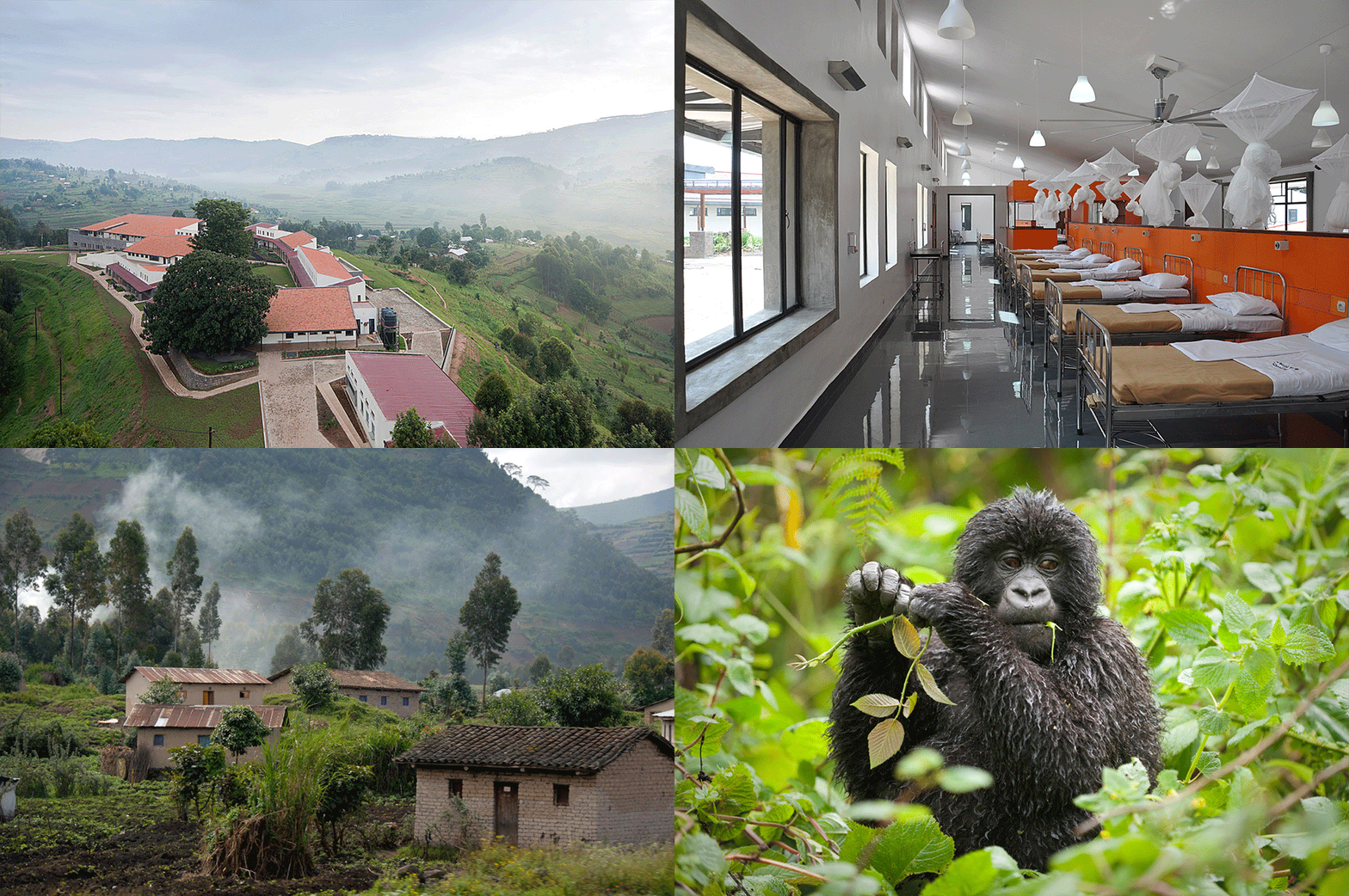
Musanze
Formerly known as Ruhengeri, Musanze is the fourth largest town in Rwanda and is quickly growing into a bustling metropolis. The Musanze district is one of thirty districts in all of Rwanda and one of five districts in the Northern Province. The Northern Province is the smallest province in Rwanda (other than the city of Kigali), but it is also the most densely populated with an estimated (as of 2009) 1,650,704 inhabitants. Each district in Rwanda is divided into Sectors, which are then divided into Cells, which are split up into Umudugudus or Villages. The Musanze district is split up into 15 Sectors, 68 Cells, and 432 Umudugudus/Villages, which brings the population to approximately 350,069 inhabitants.
Climate
Situated at an altitude of 1,850m, Musanze has one of the most agreeable climates in Rwanda. Warm and breezy days are followed by cooler nights in which it is not surprising to find most Rwandans in a light sweater. However, depending on the time of year, you may want to bring your rain gear, as the rainy season can be pretty intense in Rwanda. April and May bring about the heaviest rains, whereas October and November have a much more moderate rainy period. Average amount of rainfall during the rainy seasons is 1,000-1,200mm. per month.
Geography
Musanze is the most mountainous part of Rwanda and contains the largest part of the Volcanoes National Park. Five of the eight volcanoes of the Virunga chain, Karisimbi, Bisoke, Sabyinyo, Gahinga and Muhabura, are within the district boundaries. Karisimbi is the tallest point in Rwanda at 4,507m and is the sixth tallest peak in Africa. The Rwanda-Democratic Republic of Congo border crosses over the peak of Karisimbi.

Vegetation
With the majority of the districts population working in agriculture, most of Musanze’s jagged countryside has been stripped of its foliage and farmed to grow pyrethrum, sorghum, potatoes, etc… The Volcanoes National Park is still a rich and luscious habitat of green vegetation and animal life, but farmers outside of the park have taken over the land all the way up to the park boundaries.
People
Rwanda is the most densely populated country in Africa with over 11 million inhabitants, and there are 350,069 people living within the Musanze district. Despite the memorials dedicated to the victims of the 1994 genocide, that can be found all over the district, not a sign of animosity can be found. Individual attitudes may vary, but the country as a whole seems energetic in their efforts towards reconciliation and a peaceful coexistence.
East African Community
The East African Community (EAC) is the regional intergovernmental organization of the Republics of Kenya, Uganda, Tanzania, Rwanda, and Burundi with its headquarters in Arusha, Tanzania. The Republic of Rwanda agreed to the EAC Treaty on June 18, 2007 and became full members of the community on July 1, 2007.
The objective of the EAC is to provide a secure, prosperous, stable, and politically united East Africa. Through economic, political, social, and cultural prosperity the East African community will be able to improve the quality of life of its inhabitants.
Security
Rwanda is one of the safest countries in Africa largely due to the extremely disciplined and sizeable military and police force. Constant patrols by both forces ensure the safety and well being of Musanze’s inhabitants and visitors, so don’t be surprised if you see a armed guard strolling through the streets with an AK-47!
Basic Information:
- Languages: English, French, and Kinyarwanda
- Latitude 1°30’6. 94″S
- Longitude 29°37’59. 75″E
- Climate: 18°C / 66.2°F
- Average Rainfall: 1,000-1,200mm
- Altitude: 1,850m (6,070 feet)
- Time zone: Africa/Kigali, GMT +2 (During Daylight Savings Time), GMT +3 (Not During Daylight Savings Time).
- Sunrise: 06:05 (approx.)
- Sunset: 18:10 (approx.)
- Sectors of Musanze (15): Busogo, Cyuve, Gacaca, Gashaki, Gataraga, Kimonyi, Kinigi, Muhoza, Muko, Musanze, Nkotsi, Nyange, Remera, Rwaza and Shingiro.
- Cells: 68
- Villages/Umudugudus: 432
- Population: 350,069
- Gross Surface Area: 530km2/ 200mi2
- Gross Density: 593km2/ 1,536mi2
- Volcanoes National Park: 130km2/ 80mi2
- Lake Ruhondo: 28km2/ 11mi2
- Clear Surface Area: 442.4km2/ 170mi2
- True Density: 710km2/ 1,839mi2
- Electricity: 230/240 volts/ 50 hertz
- International Dial Code: +250
- Currency: Rwanda Franc (RWF)
- National Parks: Volcanoes National Park
- Tallest Peak: Karisimbi 4,507m (14,787 feet)
- Main Bodies of Water: Lake Ruhondo
